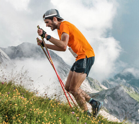
Whether you’re a beginner or an experienced runner, trail running invites you to explore new horizons, take on challenges and enjoy unforgettable experiences in the heart of nature.
The Annecy Mountains region is one of the must-visit destinations for trail running in Haute-Savoie. With its alpine pastures, panoramic ridges and iconic peaks, this region offers exceptional terrain for runners seeking to connect with nature and push their limits. On official trails starting from La Clusaz, Le Grand-Bornand, Manigod, Saint-Jean-de-Sixt, Thônes, Dingy-Saint-Clair and Le Bouchet Mont Charvin, the routes are mainly suited to runners in good physical condition.
Every run is an opportunity to discover spectacular scenery, from alpine chalets to breathtaking views of the Aravis range, Mont Blanc and the surrounding mountain ranges.
Most of the routes are classified as difficult, with significant elevation gains and technical trails, but a few accessible loops offer an excellent introduction to this mountain sport.
Beginners can try their hand at the 7km loop with minimal elevation gain starting from Thônes: ‘Paradis – Forêt du Mont – La Curiaz’, whilst more experienced runners can take on the challenge of the ‘Grand Tour du Grand-Bornand’, classified as expert level with nearly 40 km and 2,150 metres of elevation gain.
Among the must-try routes in this discipline is the Bélier trail (27 km) starting from La Clusaz, it follows the course of the “Bélier Trail & Rando” race, which draws nearly 4,000 trail runners every summer. Then there’s also the ‘Vertical Kilometre’ in Manigod: a route with 1,000 metres of elevation gain over less than 3 km – one of the shortest in France – tested and approved by Kilian Jornet.
To ensure your outings are safe, it is essential to choose a route suited to your ability. Once you’ve downloaded your GPX track onto your smartphone, don’t forget to check the weather forecast and pack suitable kit. Take plenty of water and snacks with you, let a friend or family member know your route, and stay on the marked trails.
Please note: the ‘trail’ markers are positioned along the existing signposting of the Departmental Plan for Walking and Hiking Routes. However, we recommend that you also download the GPX track to help you follow the route.
Show respect for other mountain users, livestock, pastoral areas and all the natural spaces that make our region so special. By following these best practices, you’ll be able to fully enjoy a trail running experience that combines performance, safety and the chance to discover the most beautiful landscapes of Haute-Savoie.
Find all the information you need and download the GPX files using the “LAC ANNECY ARAVIS OUTDOOR” app (english version available).
Download it for free by clicking on this links:


Or scanning the QR code below: